TrueNorth SkyWorks provides premier aerial cinematography and precision mapping, capturing the scale, prestige, and unique character of Northern California.
Check it out
Elevating property presentation. We deliver comprehensive visual marketing solutions, capturing the prestige, scale, and unique character of high-end estates to attract discerning buyers.
Art meets precision. We craft richly detailed topographical maps and 3D terrain models — turning raw landscape data into high-resolution geospatial intelligence for planning, design, and development.
Some shots only exist from above. We shoot high-resolution aerial stills with an eye for composition, light, and texture — images sharp enough for print, broad enough for any subject.
Beyond photography. Using Gaussian splat technology, we reconstruct estates as photorealistic 3D environments — not stitched panoramas, but true volumetric spaces you can move through freely. Remote clients experience the light, depth, and atmosphere of a property as if they were standing inside it.
Beyond our core services, we are always looking to partner on unique creative endeavors, commercial shoots, and custom mapping projects. If you have a vision, let's bring it to life.
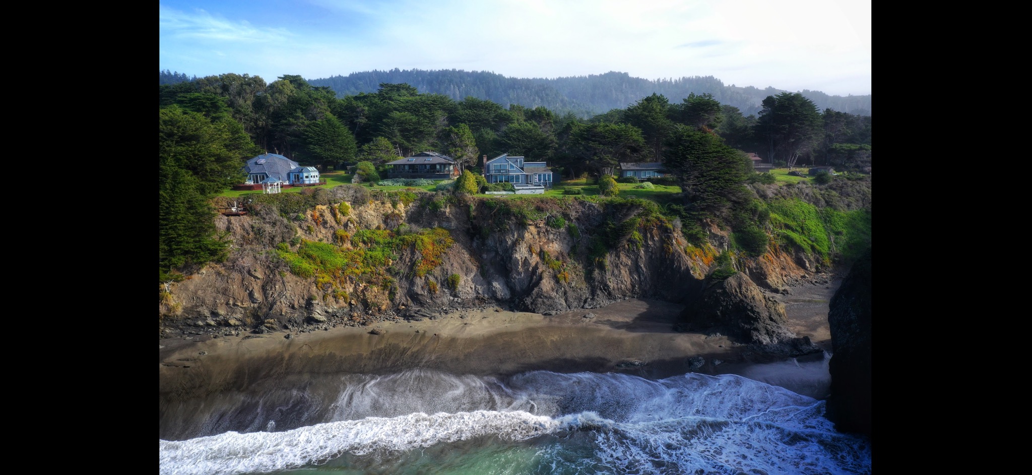
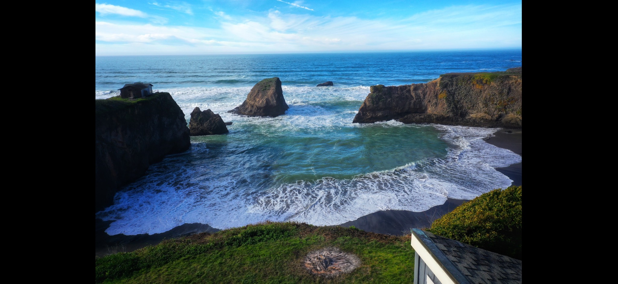
Capturing the dramatic tension where architecture meets the Pacific. Our lenses frame sweeping vistas and the raw elements that define Northern California's coastal properties.
View GalleryDocumenting the geometry of the vines and the grandeur of wine country chateaus. We blend artistic cinematography with multispectral analysis to tell the complete story of the land.
View Gallery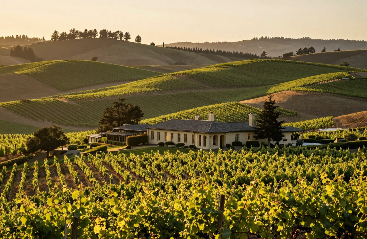
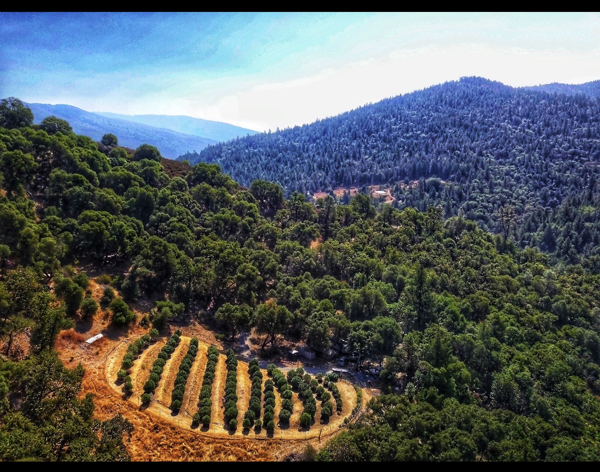
Discreet, high-end visual documentation for elite mountain estates. We showcase the scale of cultivation alongside precise topographical data wrapped in stunning promotional media.
View Gallery